Lochs and Glens Books

Wednesday 28 February 2007

Tour Glencoe


Glencoe, Scotland, ranks among the most famous historic sites in Scotland, notable because of the infamous massacre, in 1692, of the MacDonalds of Glencoe, the smallest of the Clan Donald sects. Although worse atrocities involving greater slaughter have occurred during Scotland's turbulent past, the Massacre of Glencoe has earned a unique place in the lore of the Highlands because of its treacherous and brutal manner of execution. Tour Glencoe. Tour Scotland.

Glencoe and Beyond


Glencoe and Beyond. This perceptive and informative study examines all these aspects and shows ultimately that chiefs, tacksmen, clansmen, and even southern sheep-farmers were all individuals reacting to the circumstances in which they found themselves, and that these circumstances themselves were characterised by a great deal of economic turbulence. It has been widely accepted in the past that sheep-farming in the Highlands was developed and undertaken by southern incomers; some modern historians have even dismissed the possibility that Highlanders could have become sheep-farmers because they lacked the necessary skill and capital. Ian S. MacDonald's meticulous research disproves this and illustrates that in the late eighteenth and early nineteenth centuries that while some southern sheep-farmers did indeed move into the Highlands, they were in fact greatly outnumbered by native Highlanders, who saw a future in sheep-farming, initiated it themselves, and pursued it vigorously, as is shown when the Minister of the Parish of Kilmanivaig wrote about sheep-farming in 1842: It is supposed that there are upwards of 100,000 sheep reared in this parish every year, Mr Cameron, Carychvilly [Corriechoille], the most extensive grazier in the north, stated a few years ago, that in the preceding year he had clipped upwards of 37,000 sheep, Mr Greig of Tullach [Tolloch], and the Messrs M'Donnell of Kappoch, are supposed to have each near 100 square miles under sheep: the one on the north and the other on the south banks of the Spean. Glencoe and Beyond: The Sheep-farming Years, 1780-1830.

Glens of Silence


Glens of Silence. During the last years of the eighteenth century and the first half of the nineteenth, tens of thousands of Highlanders were forcibly removed from land on which their families had lived for generations. Often evicted in the most autocratic and brutal manner, they were moved to marginal and unworkable areas, often on the coast, while the land from which they were wrenched was given over to large-scale sheep farming. Many were subsequently forced to make new lives for themselves in the Lowlands or colonies after their failure to make any kind of living on such unproductive soil, a dismal situation which was compounded by the potato famine of 1846. Stunning colour photographs depict the actual townships as they are today and the landscapes from which so many were banished, each conveying not only the natural beauty and colour of some of Scotland's most spectacular scenery, but also capturing the spirit of these places that witnessed such traumatic and shattering events. The Glens of Silence: The Landscapes of the Scottish Clearances.

The Story of Loch Ness


The Story of Loch Ness. Known throughout the world for its legendary inhabitant, Loch Ness has inspired folklore and fascination in the hearts of those who visit it for centuries. But what of the characters, the history and the myths which enchanted inhabitants and travellers alike long before the first sightings of the so-called Loch Ness Monster? Katharine Stewart takes us on a journey through the past and the politics, the heroes and villains, and the natural beauties that are the true source of the magic of Loch Ness. Where did the name Loch Ness come from, and how did Cherry Island come to be? What can be said of the wildlife that makes its home around the loch? Who determined the fate of the Loch Ness valley as we know it today?
While the depths and secrets of Loch Ness may never be revealed entirely, Stewart provides the answers to these and so many other questions in this compelling guide to one of Scotland's most famous places. The Story of Loch Ness.

Fishing Scottish Lochs


Fishing for Wild Trout in Scottish Lochs. A detailed study of the natural history of Scotland's trout. The ecological and social development of loch fishing is examined and the diversity of lochs and key factors affecting successful fishing. A section describing the legal implications of where one can fish is included. Fishing for Wild Trout in Scottish Lochs.

Folklore of Scottish Lochs

This book explains and interprets the origin of superstitions connected with Scottish lochs and springs. It sheds light on how these misinterpretations have come about and how the imagination can distort reality. Partial Contents: Worship of Water, How Water became Holy, Saints and Springs, Stone Blocks, Healing and Holy Wells, Water-Cures, Water-Spirits, Charm-Stones, Sun-Worship and Well-Worship, Wishing-Wells. Folklore of Scottish Lochs and Springs (1893).

Glens of Argyll


Glens of Argyll. The Glens of Argyll includes: Oban, Lorn to Inverary, East of Loch Awe, and Cowal Knapdale, and Kintyre. The Glens of Argyll (Scottish Glens).

Trossach Glens


Trossach Glens. The Glens of Trossach includes: Queen Elizabeth Forest Park, South Tayside and Lochearnhead, Callendar to Comrie and Crieff and the Ochil Hills. Trossach Glens: A Personal Survey for Mountainbikers and Walkers (Scottish Glens).

Lochs and Glens


Lochs and Glens of Scotland. The part played by the last ice age in moulding and sculpting the landscape, and directing and redirecting the flow of rivers and lochs has given us much of our scenery, but the underlying structure was determined by earlier geological history. To this we owe the slabby magnificence of the Torridonian sandstones found in the North-west Highlands, the rugged grandeur of Glencoe, the granite plateau of the Cairngorms. The distinctive appearance of each stretch of country is due to the character of the underlying rocks. At Elphin in Sutherland, after travelling through wastes of peat and ancient rock and seeing those extraordinary sandstone structures Stac Pollaidh and Suilven, we come into a green haven, a patch of the limestone that outcrops from Durness on the north coast down to Skye. Further south, in Wester Ross, one can drive over the rugged desolation of the Bealach nam Bo, look across the Applecross peninsula, and come down to the jewel-like green of that ancient holy place, the sanctuary of Saint Maol Rubha, endowed with a more generous geology. Lochs and Glens of Scotland.

Atholl Glens


Atholl Glens. The Atholl Glens includes: The Glens East of Drumochter, Glen Tilt to Cairnwell, and Aberfeldy to Dunkeld. Atholl Glens: A Personal Survey of the Atholl Glens for Mountainbikers and Walkers (Scottish Glens).

Glens of Ross-shire


Glens of Ross-shire. The Glens of Ross-shire includes: Inverness to Shiel Bridge, Easter Ross, Wester Ross. The Glens of Ross-shire: A Guide for Walkers and Mountainbikers (Scottish Glens).

Power from the Glens


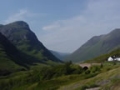
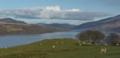
The Dambuilders: Power from the Glens. In the 30 years between the end of World War II and 1975, the construction schemes of the North of Scotland Hydro-Electric Board changed the face of the Highlands and brought electricity to almost the whole of the country north of the Highland Line. Nothing on such a scale had been attempted before, and the "schemes", as they were called, symbolized far more than huge devices for the generation of electricity. Fired by the idealism of Tom Johnston, the Board's founder, the schemes brought regeneration and hope. This book is a vivid account of the schemes and includes eyewitness stories from many of the workers, from dam builders, engineers, tunnel tigers, linemen, who made the electrification of the Highlands a reality and now, often for the first time, tell what it was like. The names of the schemes, Loch Sloy, Glen Shira, Tummel-Garry, the Conon Valley, Glen Affric, Strathfarrar-Kilmorack, Glenmoriston-Garry, Shin, Breadalbane, Ben Cruachan - are vivid in the memories of all who worked on them, in an epic of hard physical labour in a beautiful landscape. By the time the last scheme was opened in Foyers in 1975, the engineers commissioned by the Board had built some 50 major dams and power stations, almost 200 miles of tunnel, 400 miles of road and over 20,000 miles of power line. The Board had to overcome adverse weather and thrawn geology, as well as political opposition. At the peak of construction the workforce numbered around 12,000 and included men from Ireland and many parts of Europe as well as indigenous Scots. They are all proud of what they achieved. The Dambuilders: Power from the Glens.

Glens of Wester Ross


Glens of Wester Ross. From the Applecross peninsula through Torridon, the Great Wilderness and the Fannichs to Assynt and beyond to the white mountains of the Reay Forest.

Glens of Rannoch


Glens of Rannoch. The Glens of Rannoch includes: Lochaber and the Mamores, West of Drumochter, Rannoch and Orchy to Killin.

Cairngorm Glens


Cairngorm Glens. The Cairngorm Glens includes: Braemar, Feshiebridge and Rothiemurchus, Abernethy and Tomintoul. Cairngorm Glens (Scottish Glens).

Glentanar

Glentanar is forested valley, running southwest from Aboyne, Aberdeenshire.

Glen Shira

Glen Shira is the valley of the River Shira which flows southwestwards into Loch Fyne north of Inveraray.

Glen Sannox

Glen Sannox is a valley on the island of Arran, leading down from the mountain Cir Mhor to Sannox Ray on the northeast coast of the island.

Glen Roy


Glen Roy is the valley of the River Roy which flows south to join the River Spean at Roy Bridge. Loch Lochy and Glen Roy: Spean Bridge, Invergarry and Fort Augustus (Explorer Maps).

Angus Glens


Glens of Angus. The aim in this series of books is to provide the mountainbiker and walker with information on an intended route so they know something of what to expect. One of the problems is that O.S. maps give no indication as to whether an 'other road' is metalled, a path or a forest fire break, or anything in between. Many bridges shown on O.S. maps do not exist. Rivers are difficult to judge in size from the map, and a building may be anything from a pile of stones to a maintained bothy. All is revealed without removing the sense of adventure and exploration. Gradient profiles help to assess how strenuous a route is, and each hand-drawn page contains a wealth of information. The object is to save wasted leisure time and enable the armchair explorer to plan ahead or relive experiences. "The Angus Glens" include: the glens of western Angus: Isla, Clova, Doll, including the Backwater Reservoir; the eastern glens: Lee, Esk, and the Drumtochty, Fetteresso and Durris forests; and the Deeside glens: Callater, Gelder, Girnock, Muick, Tanar. Glens of Angus (Scottish Glens).

Glen Prosen

Glen Prosen is one of the Angus glens, carrying the Prosen Water to join the South Esk at the foot of Glen Clova.

Glen Ogle

Glen Ogle extends seven miles northwest from Lochearnhead, following the course of the River Ogle. The main A85 road passes through the glen, and the former Callander and Oban Railway through the glen is now a cycleway.

Glen Lochy

Glen Lochy is a valley, in Argyll, of the River Lochy which flows southwest to join the River Orchy near Dalmally.

Glen Lochay

Glen Lochay is a valley off the River Lochay which flows east to Loch Tay at Killin.

Glen Isla

Glen Isla is the most westerly of the Angus glens, valley of the River Isla which flows south from Glenshee, eventually joining the River Tay to the east of Coupar Angus.

Glen Garry

Glen Garry is the valley of the River Garry which flows east from Loch Quoich to Loch Garry. It belonged to the MacDonnells of Glengarry. Their chief raised a regiment, the Glengarry Fencibles, in 1774. Between 1802 and 1804 many of the Glengarry Fencibles emigrated to Glengarry County, Ontario, where the regiment was re-formed and fought against the American invaders in the war of 1812.

Glen Fruin

Glen Fruin is a valley, near Helensburgh, of the Fruin Water which flows southeast to Loch Lomond. In 1603 a battle here between the Colquhouns and the MacGregors led to the proscription of the MacGregors.

Glen Finnan


Glenfinnan is a village at the mouth of Glen Finnan and at the head of Loch Shiel, on the Road to the Isles from Fort William to Mallaig. It was here that Prince Charles Edward Stewart gathered his supporters and raised his standard at the start of the 1745 Jacobite Rising. A tall column topped with a statue of a clansman stands as a memorial on the lochside, erected by Alexander Macdonald of Glenaladale in 1815. Glenfinnan is also known as one of the most spectacular points on the West Highland Railway line, with an impressive twenty one arch concrete viaduct, built by Sir Robert MacAlpine. Ardgour and Strontian, Glenfinnan, Loch Eil and Loch Shiel (Explorer Maps).

Glen Feshie

Glen Feshie is a valley, to the west of the Cairngorms, of the River Feshie which flows northwards to join the River Spey at Kincraig.

Glen Etive


Glen Etive is a mountainous valley of the River Etive, running southwest from Glencoe to Loch Etive. Glen Coe and Glen Etive, Ballachulish and Kinlochleven (Explorer Maps).

Glen Esk


Glen Esk is the most easterly of the Angus glens, the valley of the River North Esk, which flows east from the Grampian mountains and then southeast. The Glen Esk Folk Museum, is housed in a former shooting lodge, is at Tarfside, nine miles northwest of Edzell. Glen Esk and Glen Tanar: Aboyne and Mount Keen (Explorer Maps).

Glenelg

Glenelg is a village in a remote Highland peninsula, lying across the Sound of Sleat from Skye. A ferry crosses to Kylerhea, following a route once popular with cattle drovers. Two well-preserved brochs are nearby, in the care of Historic Scotland. The area featured in Gavin Maxwell’s novel Ring of Bright Water and a cairn marks the site of his cottage. The Saga of "Ring of Bright Water": The Enigma of Gavin Maxwell.

Glen Douglas

Glen Douglas is the valley of the Douglas Water which flows east-wards to enter Loch Lomond at Inverbeg.

Glen Doll

Glen Doll is one of the Angus glens, a valley of the White Water which flows southeast to join the South Esk at the head of Glen Clova. Surrounded by mountains, it is a popular glen for walkers.

Glen Docherty

Glen Docherty is a valley that runs from a point five miles west of Achnasheen northwest to Kinlochewe. There are excellent views of Loch Maree and the mountains surrounding it. Tour Wester Ross.

Glendevon

Glendevon is the valley of the River Devon running east through the Ochil Hills to the village of Glendevon. The fifteenth century Glendevon Castle belonged to William Douglas, 8th Earl of Douglas. It was extensively rebuilt in later centuries, and is now privately owned. Ochil Hills (Superwalker).

Glen Dessary

Glen Dessary is the valley of the River Dessary which flows southeast from Garbh Chioch Mhor, to join the River Pean just to the west of the head of Loch Arkaig. The village of Glendessary is near the foot of the Glen.

Glen Derry

Glen Derry is a valley in the Cairngorms of the Derry Burn which flows south to join the Lui Water at the old Derry Lodge.

Glen Calvie

In 1845 the people of Glencalvie were evicted from their homes by the Duke of Sutherland and took shelter in nearby Croick Church, one of the Parliamentary churches, built in overcrowded parts of the Highlands in the 1820s. Tour Sutherland.

Glen Brittle

Glen Brittle is the valley of the River Brittle which flows from the Cuillins in Skye, west and then south to enter Loch Brittle. The village of Glenbrittle lies on the coast at the end of the glen. Overlooked by the spectacular Cuillin Mountains, Glenbrittle Youth Hostel is a great place to spend a few days. A fantastic base for walkers and climbers.

Glen Artney


Glen Artney is the Valley of the Water of Ruchill which flows northeast and then north to join the River Earn near Comrie. It appears in Sir Walter Scott’s The Lady of the Lake. Crieff, Comrie and Glen Artney (Explorer).

Glen Affric


Glen Affric is the forested valley of the River Affric which flows northeast through Loch Affric to join the River Glass near Cannich. The glen is surrounded by Munros, making it popular with walkers and climbers. Glenaffric Forest also offers walks and wildlife. Glen Affric and Glen Moriston (Explorer Maps).

Glen Trool


Glen Trool is located in Galloway, about ten miles north of the attractive little town of Newton Stewart. It is a deservedly popular beauty spot in mainly lovely high hill country. It is pleasantly approached from Newton Stewart by following the road, which runs close by the river Cree, as far as Bargrennan. Fork right here and another right turn across the Minnoch Water brings a first glimpse of Loch Trool in its magnificent setting of heather clad hills. Galloway Forest Park North (Explorer Maps).

Glenshee


Glenshee, the Fairy Glen, has a strong tradition of the Fingalians whose fighting capacity and exploits of adventurous courage are still spoken of in Highland history. Their period of time is generally supposed to have been the fourth century. It is said the Fingalian warriors hunted the wild boar when it roamed in upper Glenshee. Glenshee and Braemar: The Cairnwell and Glas Maol (OS Explorer Map).

Glen Tilt


Glen Tilt extends north eastwards for about twelve miles from Blair Atholl. There the river Tilt joins the Garry. A road penetrates seven miles up the glen but the track through to Mar on Deeside is a right of way. King Robert the Bruce is said to have come this way from Deeside whilst heading westward with his force to the battle of Dalrigh which was fought at Tyndrum near the Perth and Argyll county boundary in 1306. Atholl: Glen Tilt, Beinn Dearg and Carn Nan Cabhar (Explorer Maps).

Glen Rosa


Glen Rosa is one of Scotland’s most attractive glens. It runs north-west from Brodick, on the Island of Arran, before turning north. Small trout abound in the clear waters of the little river Rosa and no roadway mars the perfection of its setting. The wide valley mouth above Brodick is graced on its northern face by Brodick Castle. It was once stormed by the armies of Robert the Bruce and he later used it as a base for the mainland campaign which terminated at Bannockburn in 1314.

Monday 26 February 2007

Glen Nevis


Low and high level walks for families or individuals visiting the Fort William area, to walk within their limits. Walk the best mountains and glens in the area on some of the less frequented routes around Glen Nevis. Sixteen page booklet complete with simple sketch maps. 17 Walks in Glen Nevis.